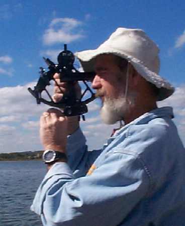
Using a Sextant
Celestial Navigation
Celestial navigation is one of the oldest and most reliable methods of navigation for the open seas. The navigator use the sun, moon, stars, and planets to determine the ship's position.
Since the earth is a sphere, every celestial body can be connected to a point on the earth's surface with an imaginary line from the center of the earth to the celestial body at any moment in time. This point is the geographical position (GP) of the celestial body.
The navigator measures the altitude of a celestial body with a sextant. This is the angle between the body, for instance the moon, and the horizon. The navigator then measures the altitude of a second celestial body, perhaps the north star, and records both altitudes and the time. He can then calculate the GPs of both bodies, narrow the possible position of the ship with piloting or dead reckoning, and then use the available information to calculate the ship's position.
In earlier times, the North Star was always used to calculate position.
Using a Sextant
For More Information: